Tour Fermoy
Page 3
by Paudie McGrath
The first Loretto Nun’s came to Fermoy in 1853.
In 1838 the Presentation Nuns
came and opened a School and
St. Colman’s College was opened in 1858.
On the western side of Queen’s (Pearse) Square lies St. Patrick’s Catholic Church.
|
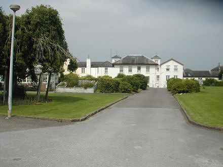 Loretto Convent, Fermoy Loretto Convent, Fermoy |
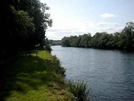 Blackwater River Blackwater River |
Next you turn left into King Street,now MacCurtain Street, passing
Abbey Street which connects with Ashe Quay formerly known as
West Quay and Grubbs Quay on the southern bank of the
Blackwater River.
Next on the right there was a small street called
Catherine Street which is now gone but the stone nameplate is still on the
gable end wall of Mason’s shop. Catherine Street used to connect with
Vulcan Street which is also known as Forge Lane.
The Royal Irish Constabulary Barracks is on your right. This building was for
many years the
Fermoy Garda Station and more recently became the Fermoy Resource Centre.
It was the only building that faced onto Catherine Street.
|
There are still what are believed to be, traces of the Cistercian Abbey called
‘Our Lady De Castro Dei’,
which was founded in 1270 in the area
behind this building
(the Royal Irish Constabulary Barracks). Very little can be traced of this
Abbey but it seems to
have been in the area between
King Street (MacCurtain St.) and the
River and it probably stretched from
Barnane, well downriver to the Bridge. In about the year
1540
when the Dissolution of Monasteries was ordered by Henry VIII, (1546-1541)
the monks were driven from their
Monastery and probably murdered.
The lands were taken over by a
Sir Bernard Grenville, son of Sir Richard Grenville;
the beautiful Abbey was left desolated and uncared for and fell into ruin.
Much of the limestone from the
Abbey was re-used during the building of Fermoy town from the 1800s onwards.
|
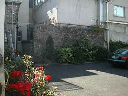 Remains of the Abbey Remains of the Abbey |
 Clarke Street Clarke Street |
On the left side of King (McCurtain) Street is Clarke Street which was originally called
Barrack Street and was also known as Pump Lane. This street connects
King Street with Prince's Street, which is now Connolly Street.
The British Military were housed in this area while waiting for the main Barracks to be built.
The first barracks became occupied from about 1804.
All the British Army’s property in Fermoy, the barracks,
hospitals, stables, coach houses etc. were all
burned to the ground during The Troubles in 1923.
Prince's Street (now Connolly Street) was a very important
centre and was home and business to many families.
|
In the 1920’s there were 72 houses occupied in
Connolly Street and many of these houses had two or more families living in them.
From Prince's Street you will go up Bridewell Hill
now known as Kevin Barry Hill, which in the 1920’s had 18 families residing there.
At the top of Bridewell Hill you come out onto Emmet Street which was then called
William Street and in earlier years known as Newtown. From here you walk up
Pound Lane (Devlin Street) to Springfield Cottages, which were at the top of
Pound Lane.
These cottages have long since gone. However, there are still visible signs of
doors and windows on the wall at the top of Devlin Street. From here you make your way
along the White Wall as far as the junction of
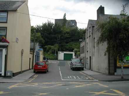
Cross Street, which is now named Clancy Street
|
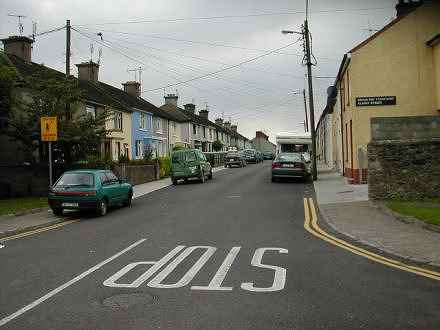
Clancy Street from Emmet Street |
Page 4
© Paudie McGrath Cork Ireland 2003 -
|


