Tour of Fermoy
Page 4
by Paudie McGrath
At the end of Cross Street you exit again onto William Street or Newtown. (Emmet Street)
We are now facing down Grubb’s Hill now called
Monument Hill or St.Colman’s Hill. You then turn left and then left again up
Bog Lane, now Redmond Street
From the top of Bog Lane you cross by the White Wall and back onto the main
Cork Road.
You now walk down Cork Road to the crossroads and pass Parnell Terrace, on the left.
Behind Parnell Terrace was the Polo Grounds, which was used as a children’s
playground for many years. Down to the crossroads and on the left lies
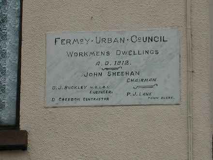
Duntaheen Road with Gratten Terrace which were the first houses built by
the U.D.C. (Urban District Council) in about 1900.
|
 Redmond Street Workmen's Dwellings Redmond Street Workmen's Dwellings |
 Larchwood Manor sign Larchwood Manor sign |
Coming back towards town again is Cork Hill, on your right and
Cork Hill Terrace, on your left, which is now McDonagh Terrace
which is also known as The Range. You then pass
Collis’s Row down by Larchwood Manor, then Briscoe Place or Victoria Terrace and
Hillside Terrace which is now O’Connell Place.
You carry on down past the Christian Young Men's Society Hall or Parish Hall.
The next Building on our right is the Bishop Murphy Memorial School
(1904),
where the Christian Brother's taught for many years. Some years ago the last of
the Christian Brother's left Fermoy.
|
|
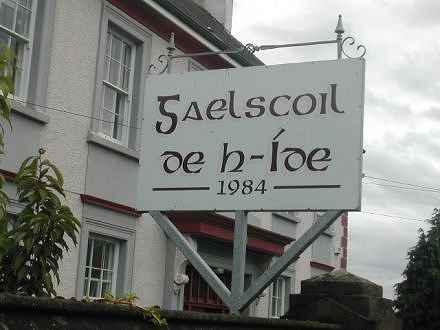
The building on our left was the Technical Institute for many years. This building is now
Gaelscoil De h-Ide. From the Gaelscoil we turn left down
Waterloo Lane towards the River. Waterloo Lane was known as
Chapel Lane way back before the present Church was built. There is no evidence of this name
in use officially but it was handed down by word of mouth for generations.
|
 Gaelscoil de h-Ide Gaelscoil de h-Ide |
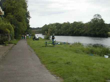
 Barnane Walk Barnane Walk |
Barnane Walk is one of the oldest place names in Fermoy.
It would seem to go back to the 12th Century to the time of the Cistercian Monastery
in Fermoy. ‘Barnane ’is a derivative use of the name Bernard, and St. Bernard is the patron
saint of the Cistercian Order. St. Bernard of Clairvaux also appears with St. Patrick
and St. Joseph on the stained glass window behind the main altar in
St. Patrick’s Church. The oldest maps show the well in Barnane as
St. Bernard’s Well. All this, together with the
fact that Fermoy UDC named one of their earliest large housing estates,
St. Bernard’s Place , indicates that St. Bernard
was associated with Fermoy for a long time.
|
|
The Rowing Club Boathouse and boat-slip were, and still are, very much associated with
Barnane Walk. Next time you take a walk up Barnane, call in to the Well and remember its
association with our town and how vital it was to the well being of both the Monks and local
inhabitants alike, of that time.
From the Square you head eastwards down Patrick Street. The first street to the left,
Kent Street, had its name changed a number of times.
Its first name recorded in the 1820’s was Nile Street after the famous African river;
it later became Bank Lane and then Bank Street.
John Anderson is said to have had his bank here. This street which connects with
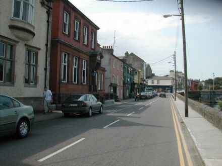
Artillery Quay is now O’Neill Crowley Quay.
|

O'Neill Crowley Quay |
Page 5
© Paudie McGrath Cork Ireland 2003 -
|

